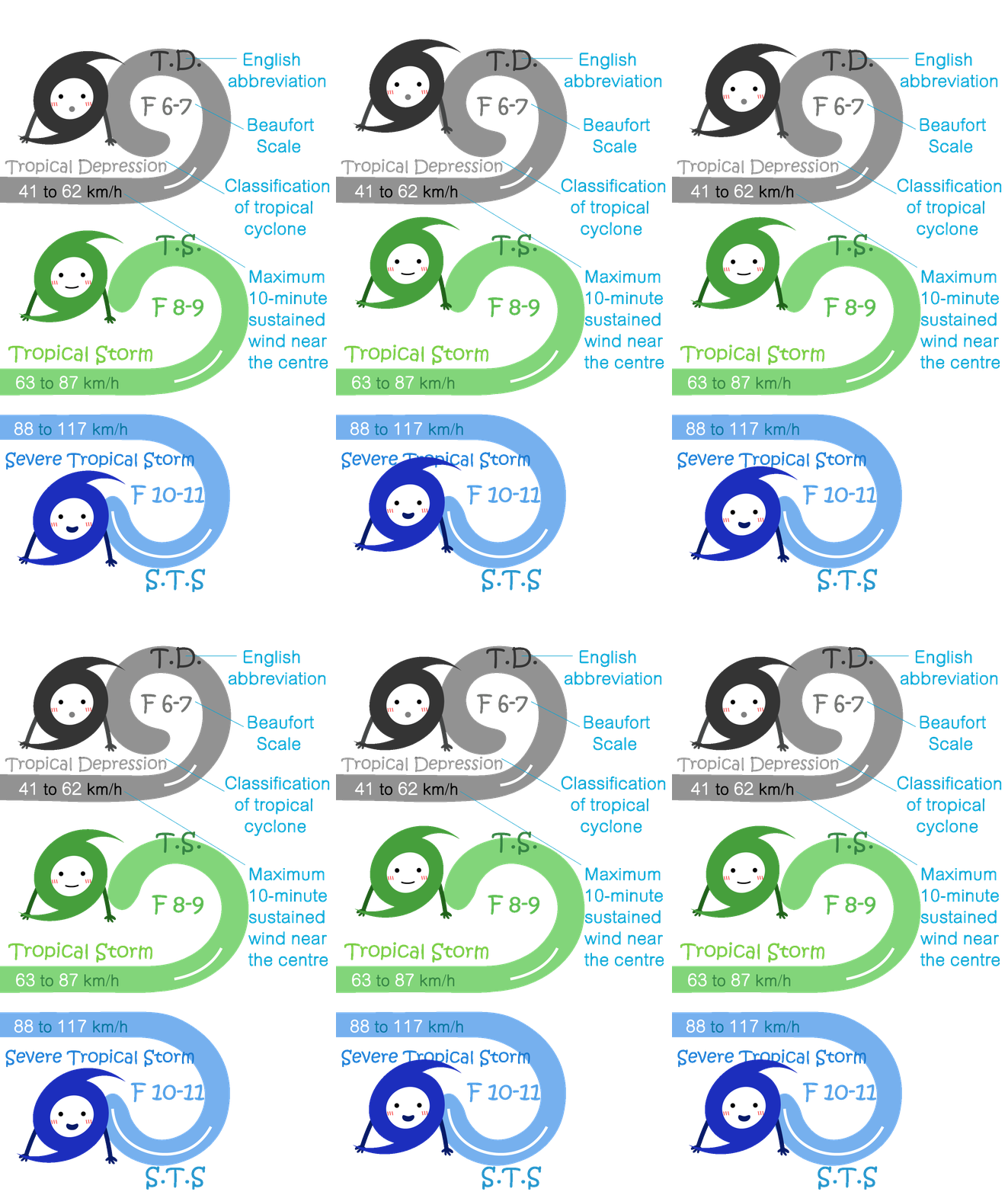
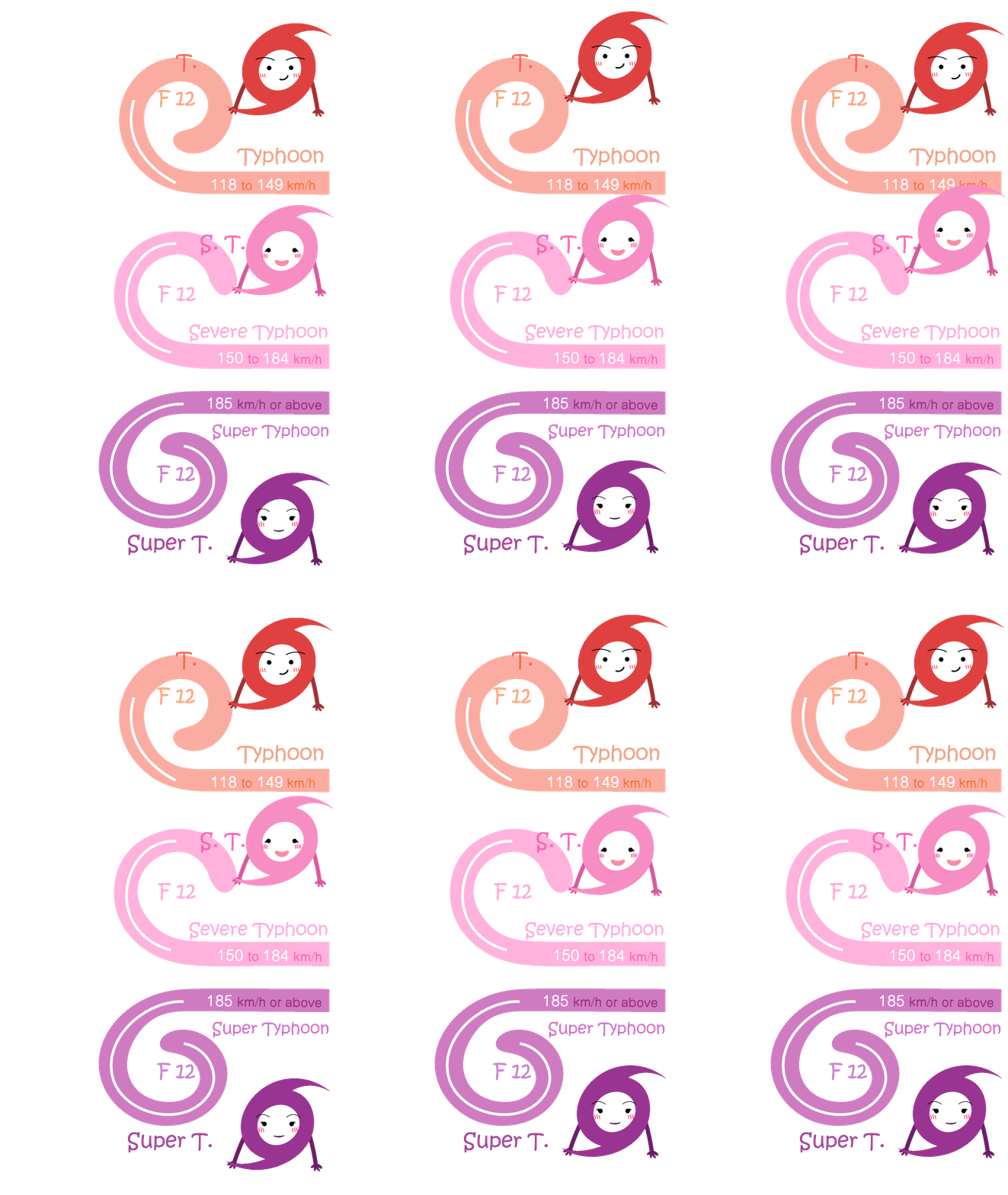
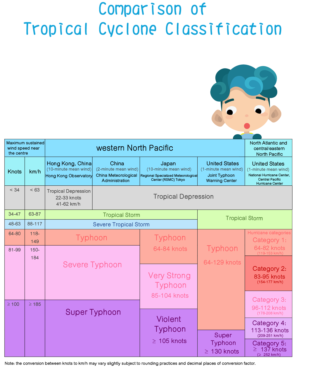
Maximum 10-minute mean wind near the storm centre
over the storm lifetime
Position of closest approach to the Hong Kong
Observatory
Lowest instantaneous (*hourly) sea-level pressure
recorded at the Observatory
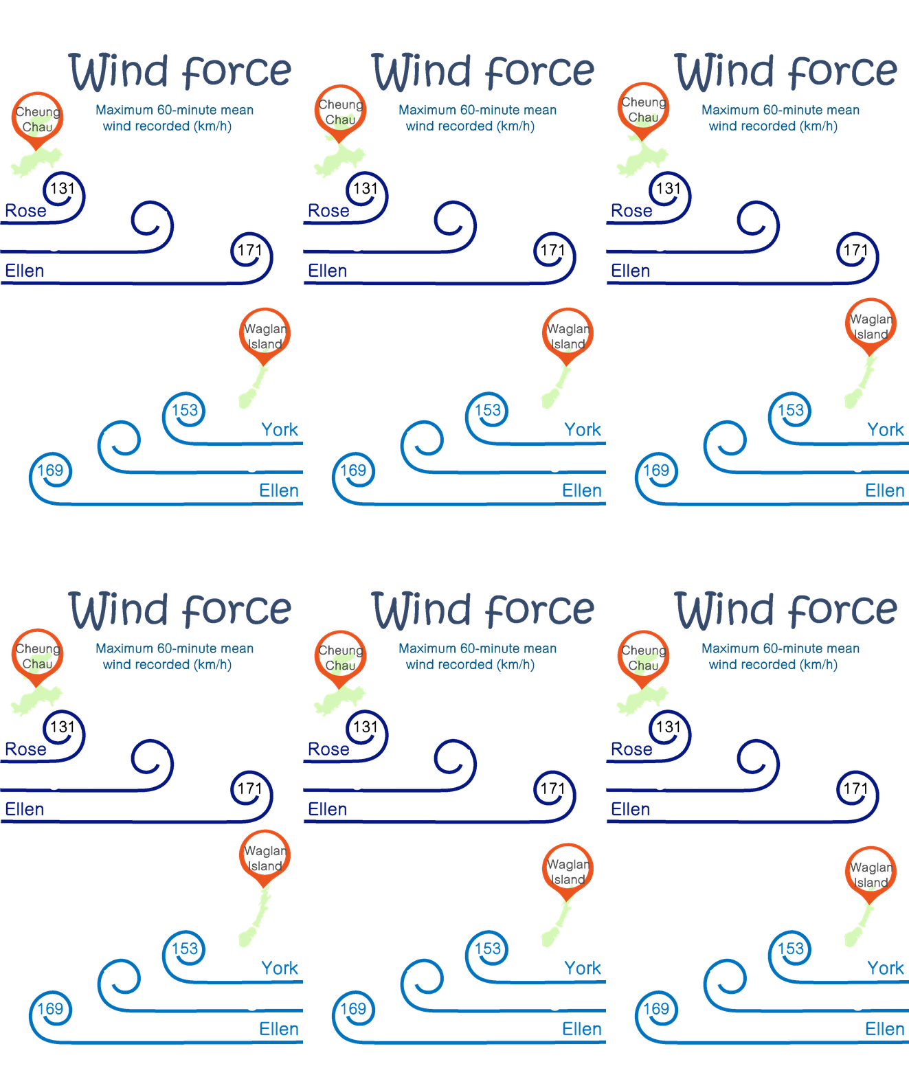
Maximum 60-minute mean wind recorded at Waglan
Island
Maximum gust recorded at Waglan Island
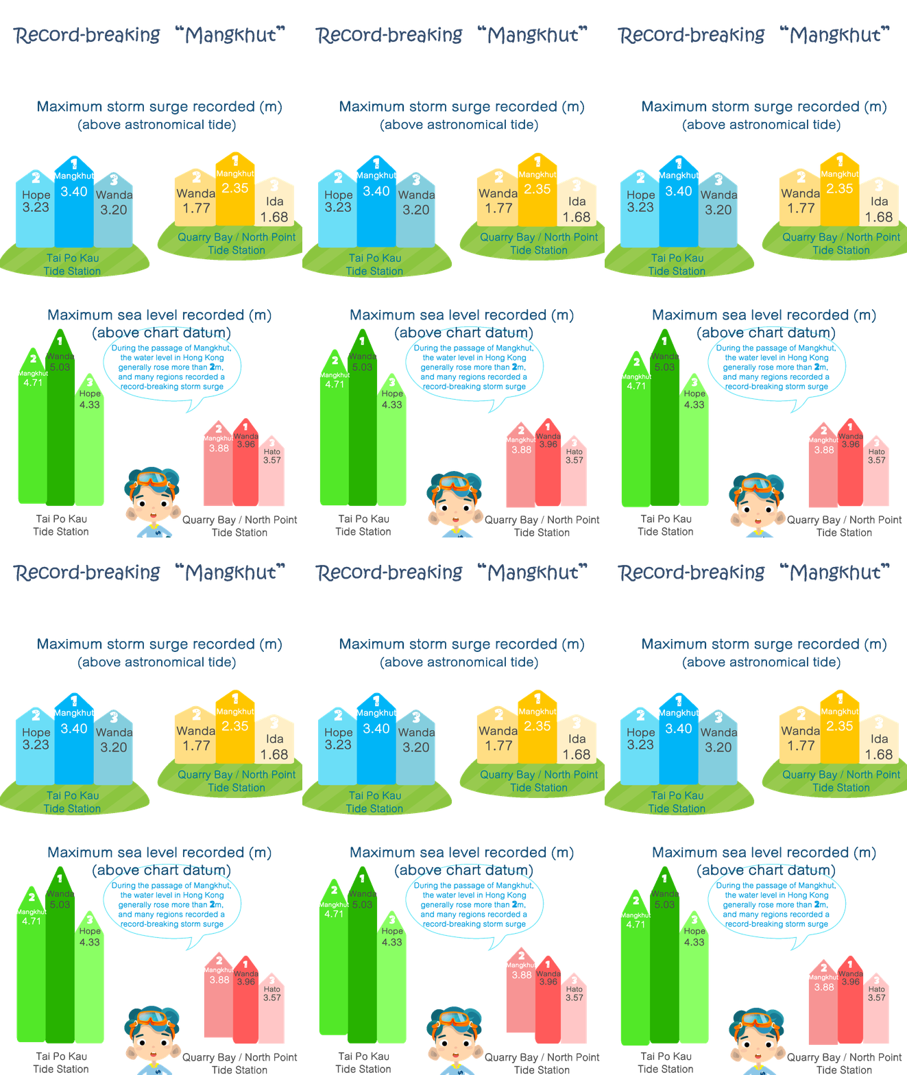
Maximum sea level recorded at North Point/Quarry Bay
(**Victoria Harbour) (above chart datum)
Maximum storm surge recorded at North Point/Quarry
Bay (**Victoria Harbour) (above astronomical tide)
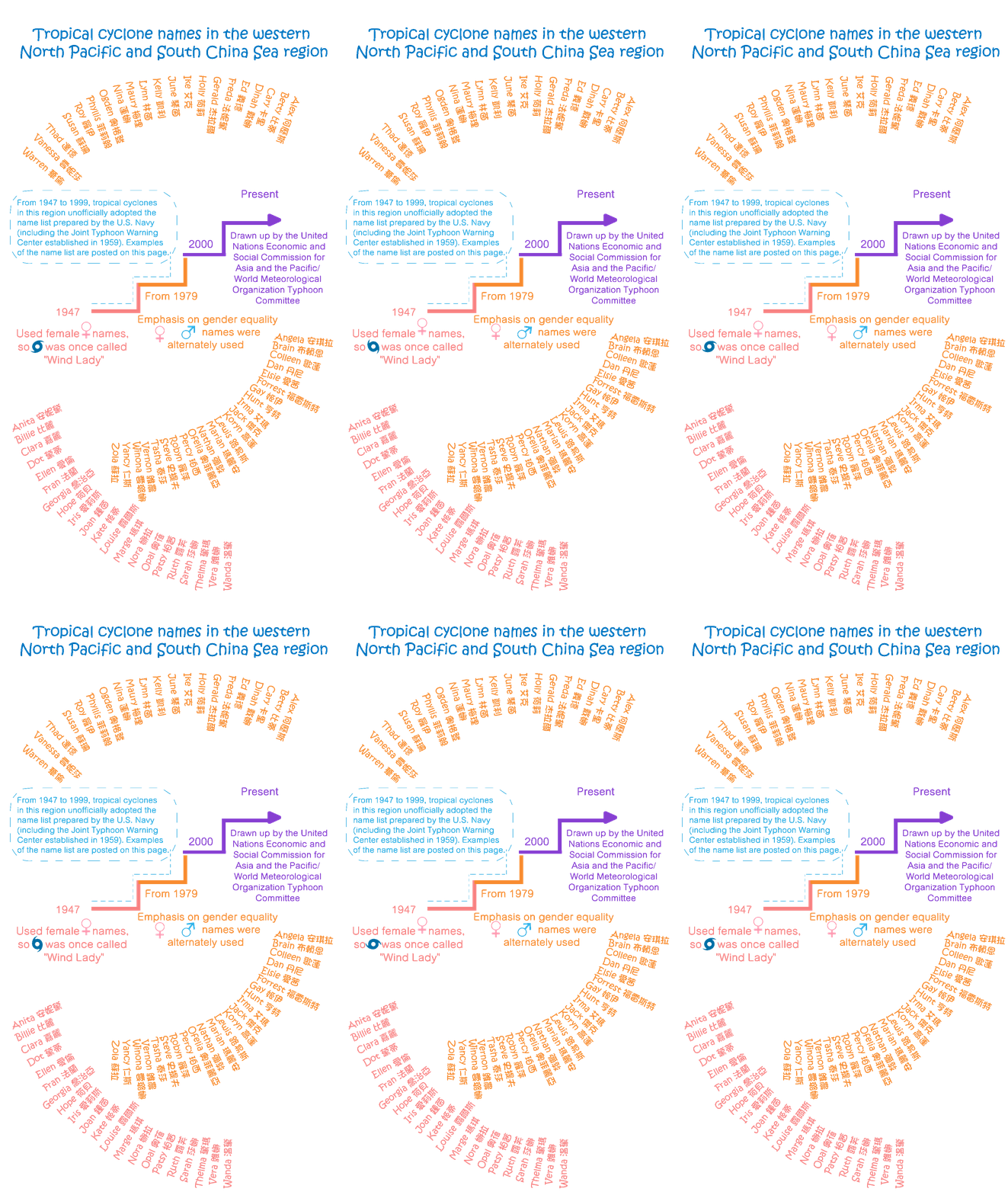
With effect from 2000, a new list consisting of totally 140 tropical cyclone
names contributed by 14 countries or territories in the Asia-Pacific region
was endorsed by the Typhoon Committee. The Japan Meteorological Agency
(Regional Specialized Meteorological Centre) will assign names from this new
name list to each tropical cyclone attaining tropical storm strength.
* Click on the
to view the tropical cyclone names in the western North Pacific and the
South China Sea with effect from 1 January
. The names may be updated every year.













 Maximum 10-minute mean wind near the storm centre
over the storm lifetime
Maximum 10-minute mean wind near the storm centre
over the storm lifetime
 Position of closest approach to the Hong Kong
Observatory
Position of closest approach to the Hong Kong
Observatory
 Lowest instantaneous (*hourly) sea-level pressure
recorded at the Observatory
Lowest instantaneous (*hourly) sea-level pressure
recorded at the Observatory
 Maximum 60-minute mean wind recorded at Waglan
Island
Maximum 60-minute mean wind recorded at Waglan
Island
 Maximum sea level recorded at North Point/Quarry Bay
(**Victoria Harbour) (above chart datum)
Maximum sea level recorded at North Point/Quarry Bay
(**Victoria Harbour) (above chart datum)
 Maximum storm surge recorded at North Point/Quarry
Bay (**Victoria Harbour) (above astronomical tide)
Maximum storm surge recorded at North Point/Quarry
Bay (**Victoria Harbour) (above astronomical tide)